Manapōuri or Motu-rau (Lake Manapōuri) Natural Heritage - History & Photos
Shared by Central & Western Murihiku Southland Archive
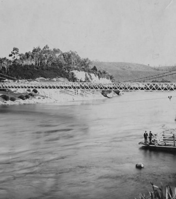
Manapōuri or Motu-rau (Lake Manapōuri) Natural Heritage - History & Photos: Photos of the lake previously known to the Māori as Motu-rau, now known as Lake Manapōuri, within the Fiordland or Te Rua-o-Te-Moko National Park. One of many thousands of natural heritage sites within that, these beautiful vistas of the lake and the mountains surrounding it, one morning and one evening, were taken by local Manapōuri resident Shirley Mouat. EARLY DISTRICT HISTORY: This area is featured in Māori legend, with the name Manapōuri said to mean "lake of the sorrowing heart", which comes from the legend about two sisters whose tears formed the lake. Despite this sad tale, the lake is beautiful, the surrounding scenery stunning, but with changeable weather. It is believed that Charles Nairn & WH Stephen, who were traveling with Commissioner Mantell when he looked over the district for the ensuing 'Murihiku Purchase', were the first Europeans to ever see Motu-rau or Lake Manapōuri, and Lake Te Anau. They certainly have proof that they saw it. In John Hall-Jones, 'Fiordland Explored', he explains how the party records their adventures, thus: "[We] struck across a large stony plain which reaches down to Lake Moturau in the west... to arrive at a very high bank", which was on the Wairoa (Waiau) River. Nairn described it as, "A broad stream flowing south from Lake Te Anau to Lake Moturau". Lake Te Anau is the true source of the Waiau River and this stretch is long and winding. We know that Nairn viewed the lake, as in 1852 he made a sketch of what he called the Wairoa River (Waiau) from Horseshoe Bend, and in this, you can see Lake Moturau in the distance. Also recognizable are Leaning Peak and the Beehive. This sketch is in the Alexander Turnbull library and a copy can be seen in the book quoted. Interestingly, it is recorded that at the foot of the very high bank explained above, was a number of eel spears found in a cache there, which the men described as their first sign on any human habitation. It was believed by J H-J that the Māori were probably very well aware of this equipment, as Horseshoe bend had a reputation as a great eeling spot. In fact, the native guides accompanying the party, insisted on staying there and going eeling, which delayed the survey party in their quest to reach Te Anau, something that Nairn writes in frustration about. EARLY RUNHOLDERS In 1854 prospective runholders arrived in the area, these being Donald Hankinson and Freeman Jackson. Jackson decided to take up land near the recently famed Motu-rau or Lake Manapōuri, first creating a home at what he aptly called 'Home Creek' which is situated below where the Waiau exits Motu-rau or Lake Manapōuri, but later relocated to a homestead at Balloon Loop, situated on the upper Waiau River, around the halfway mark between the two lakes, and he settled here permanently, until leaving the district in 1867. The homestead eventually grew over with bluegums and disappeared, with the brick chimney's being the last to crumble. A painting by CD Barraud records a good size homestead up on the terrace at the Balloon Loop site and also a cottage alongside the river. While Hankinson was to settle at Te Anau Station in 1858, this history is in another entry. The so-called 'Manapōuri Run' which is linked to McKay/MacKay brothers John and Donald, is a bit of a misnomer, as it is actually some distance from Lake Manapōuri and situated at the base of the adjacent Takitimu Mountain Range. So this too, will be left for yet another different entry. EARLY SURVEYS Chief Surveyor of Otago, JT Thomson was the first surveyor to see the above lakes, including Motu-rau or Lake Manapōuri. In writing about this, his grandson John Hall-Jones, comments that in JT Thomson's sketches from his 1857 journey up the Waiau Valley into the Takitimu's and further, he had marked on a map as North and South Te Anau. Wondering how he could have made such a mistake, Hall-Johns trekked to the same spot and indeed, both Lake Te Anau and Motu-rau or Lake Manapōuri could actually be seen from the place of his grandfathers sketch, and the South Te Anau Lake is actually Motu-rau or Lake Manapōuri. Some five years later, JTT sent assistant James McKerrow to finish off a more detailed survey of his earlier work, and he ran into a few issues with heavy rain and drownings. Eventually, with his own assistants, McKerrow was to finally get his first look at Lake Te Anau and Motu-rau or Lake Manapōuri, from up a peak in the Takitimu Mountains. After surveying other surrounding areas, they headed to 'The Plains' station and Gillow's homestead, where they borrowed a boat, to survey Motu-rau or Lake Manapōuri. A day after portaging the boat (a flat bottomed dinghy), they arrived at Motu-rau or Lake Manapōuri on 9 December 1862 and set out on the lake. Assistant John Goldie, recorded that, "Lake Manapōuri... is beyond anything I have ever seen before... containing a great number of beautiful islands... there are also a similar number of peninsulas and beautiful bays around its shoreline." An eight day trip by McKerrow produced a wonderful survey of Motu-rau or Lake Manapōuri. The team was provisioned by the nearby station of Freeman Jackson, which he named Freeman Burn after. EARLY TOWNSHIP The earliest building in the now township of Manapōuri, was a large tourist accommodation house "Grandview" that George Dore prior of Mossburn, built for Robert Murrell. His own hut was the first home built at Manapōuri. We have recently been donated a copy of the book, 'Dore to Manapōuri' so can update this record even more once we have reviewed this great work. George was an uncle of JBC Dore, the Captain of the first tourist boat on the Lake, "Titiroa", launched on 28 July 1893. Dore's own house was situated in the camping ground area below the famed Grandview House. So even though the survey of Manapōuri by James Blackie in 1883, had been undertaken some years prior to that of Te Anau, it's growth was slower and more measured. It never became a great tourist mecca and to quote John Hall-Jones, the township has "retained much original charm." William Anderson in his Milford Tales, covers how the Te Anau area was adjacent to a virtually undiscovered wilderness, prior to MacKinnon Pass being found. That was well and truly reversed as the town became the centre of the highway into Milford, many years later. Manapōuri is on the way to Te Anau from Southern Scenic Route of Murihiku, and Motu-rau (or Lake Manapōuri) is one of the districts only two Hydro Power Station Lakes. STATISTICS: Lake Te Anau is the true source of the Waiau River. The Upper Waiau River flows from here into Lake Manapōuri or Motu-rau and onwards from there until it reaches the Waiau River Mouth, in Te Waewae Bay. Lake Manapōuri or Motu-rau is smaller than Lake Te Anau, with a very irregular shoreline and many wooded islands dotting the surface, which earned it the title of, "The Loveliest Lake in New Zealand", according to the Fiordland National Park Board book, 'Fiordland National Park' written by Gerard Hall-Jones. In 1973, it is interesting to see that the visitor numbers to the district were 300,000, with THC (Tourist Hotel Corporation) operating hotels in both Te Anau and Milford, with a Motor Inn at Manapōuri & three more elsewhere. Compared to modern tourism below, numbers are now more than double! VISITING IN THE CURRENT DAY: There were 641,600 visitors logged by the Fiordland regional tourism organisation in 2023. Te Anau is on the way to Milford, so many national and international tourists pass through it, and most of these would stop, even if just to fuel up their vehicles. Many stay en route to Milford Sound. Some choose to stay outside of Te Anau in the smaller, cosier Manapōuri. There are many beautiful eateries and places to stay in Manapōuri and boat trips to Doubtful Sound and West Arm leave from there, at Pearl Harbour on the lake, another very stunning place to visit. The old Anglican Church from Ōtautau was moved to the village of Manapōuri to be used as an Art Hub and yet another old church has been converted into a modern cafe and bar. It is easy walking distance to everything, including a totally wonderful "Wee Bookshop" which has a famous author owner and many fabulous books. A turbine from the original Manapōuri Power Station at West Arm is set into the park above the Lakeside on the Te Anau Road, with information boards. A number of different walking and parking spots are available, with picnic tables to eat at and enjoy the majestic views from. One road even goes right to the lake edge. The one thing you notice about this place as opposed to Te Anau, is the sheer lack of people around. Archivists comment: At the CWA Community & Heritage Hub, operated by Central & Western Archive - Murihiku Southland, we have books, records and photos on the history of this area, lakes, mountains, tracks and more. Hopefully this entry will be added to as more information on the history comes to hand. If you or anyone you know has any more information or photos to share or accounts of the village of Manapōuri itself, Motu-rau (Lake Manapōuri), or the wider area of Fiordland or Te Rua-o-Te-Moko, please do share this with us in the comments section. You can do this by making a comment in the space provided under the image page. Or you can make contact with us as per the archive front page.
Ngā whakamārama
Details
-
Title
Manapōuri or Motu-rau (Lake Manapōuri) Natural Heritage - History & Photos
-
Maker
Mouat, Shirley
-
Date made
2025
-
Subject
Fiordland, Te Rua-o-te-moko, Western Southland, Great outdoors, Fiordland National Park, Outdoor Adventure, Manapōuri, Lake Manapōuri or Motu-rau, Milford Road, Sports & Recreation, Kiwi Holidays, Tourism, Beaches, Parks & Picnic Areas
-
Additional information
Digital only image in archive
-
Rights
Attribution (cc)
http://creativecommons.org/licenses/by/4.0/ -
View source record for this item
Kei hea tēnei taonga?
Where is this item held?
-
Additional information including high resolution images may be available.
-
Location
Main Rd, Tūātapere, next to the old Railway Station. We also belong to the internationally recognised 'Safe Space Alliance'.
Whare taonga | Organisation
Central & Western Murihiku Southland Archive
Ngā here ki runga i ngā whakaahua o tēnei taonga?
What can you do with images of this item?
-
You must check with Central & Western Murihiku Southland Archive to confirm terms of use and any attribution requirements, but this is our understanding:
-
Use for private study, research, criticism, review, or education
NZ Copyright law allows for the use of copyrighted works in specific circumstances. Consider what you can do under copyright law.
-
Share
You can share this image without further permission.
-
Modify or remix
You can modify, remix or add to this image without further permission.
-
Commercial use
You can use this image to make money.
-
Text adapted with permission from Te Papa and Digital NZ
Tāpirihia he kōrero anō
Improve this record
-
Can you help us? Share names, details and stories to help enrich the collection.