Waiau District Natural Heritage - Waiau Trust Wetlands at Te Waewae
Shared by Central & Western Murihiku Southland Archive
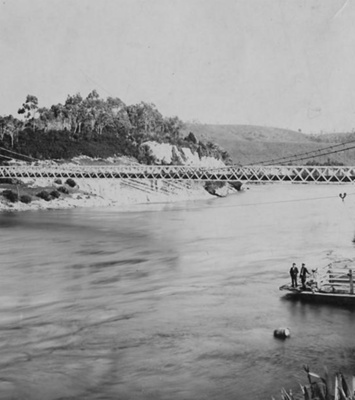
This entry is in honour of 'World Wetlands Day', held on 2 February 2025. It is held each year on the anniversary of the 'Convention on Wetlands', as adopted by international treaty in 1971. It is a sad indictment our or past lack of concern for wetlands in the south of Aotearoa NZ that between 1996 and 2018, more than half of the total wetlands in the country were lost in the Murihiku Southland Region. The project discussed here, seeks to rectify some of the losses, but much more preservation and restoration is needed. IMAGES: Collection of scenes showing the Te Waewae Wetlands, administered by the Waiau Trust. Photographs by Trevor Willets & kindly donated to CWArchives. Licensed CC BY and labelled by the photographer as 'TeWaeWae Wetlands Southland, Bird Sanctuary, and Breeding Grounds for Whitebait.' WAIAU TRUST at Te Wae Wae Lagoon: This Te Wae Wae Lagoon project has a focus on the creation of rearing habitats for whitebait (which locally is mainly inanga hatchlings) and this in turn, helps provide a safe home and nesting grounds for a diverse range of wildlife which reside or migrate to this coastal environment, including birdlife. The reason behind the Waiau Trust's work on creating wetland habitats here, is that the reduced flow of the Waiau River, the progressive development of low lying land for agriculture, the ongoing drainage of wetlands in tidal areas and the widespread modification of lowland streams, have all dramatically reduced rearing habitats for whitebait, and other species. Spawning habitats have been affected by land use change and stock trampling and grazing. It is of note that the initial work of the Waiau Trust here had been undertaken between 1998 and 2008. But more wetland restoration has continued since that date, including another 10ha of new open water wetlands, connected to the Waiau Lagoon in 2009. Another 10ha of open water wetlands were also built in 2012. Further to this, the Trust has been surveying inanga and short-finned eel colonisation of wetlands and bird species using the new habitats. WHITEBAIT CONSERVATION: The Department of Conservation or DOC, summarises what we know as 'Whitebait, as being, "the juveniles of six species of fish, five of which are migratory galaxiids: inanga, banded kōkopu, giant kōkopu, kōaro and shortjaw kōkopu. The sixth species is common smelt." Doc further inform us that the whitebait caught locally from the Waiau River, are predominantly inanga. These are "found in a wide variety of habitats, from tiny creeks, to coastal rivers, lowland streams, lakes and wetlands." Inanga are small and most only survive a year or so, reaching about 100mm in length – the longest one found on record, was 190 mm. "Because they are poor climbers, inanga are usually found near the coast. Their silvery belly and somewhat forked tail make them easy to distinguish. Found in places as far flung as Chile, Australia and Argentina, inanga are the most widely distributed native freshwater fish in the world," records DOC. They are also Aotearoa New Zealand’s most commonly caught species of whitebait. But as well as this, their population is in decline. Almost all of the Whitebait species are either in decline or threatened, hence new restrictions on catching them. If we want future generations to be able to carry on our tradition of whitebaiting, we need to preserve this previous taonga/treasure. HISTORY OF THE WAIAU RIVER & SURROUNDS: The Waiau River and "The Mouth" as it is often referred to by locals, has a rich fishing history and is of great importance to our local district. Most local families have stories of visits to the mouth, for a days outing or fishing trips. There are now generations of southerners who have fished and gathered kai or food here, both colonist pioneers and their descendants, also those from long before European settlement. Its now considered part of life', and one of the drawcards for local residents and visiting crib owners alike. Just how vital the Waiau was to Māori is clearly presented in the Ngai Tahu Settlement of 16 October 1998 in attachment 12.90A, of the Deed of Recognition for Waiau River, Southland. The deed articles include the following quotes: "Numerous archaeological sites and wahi taonga attest to the history of occupation and use of the river. These are places holding the memories, traditions, victories and defeats of Ngai Tahu tupuna. The main nohoanga (occupation site) on the Waiau was at the mouth and was called Te Tua a Hatu. The rangatira (chief) Te Wae Wae had his kainga nohoanga on the left bank of the Waiau River mouth. [NOTE: known as Te Waewae Bay to this day]. The Waiau, which once had the second largest flow of any river in New Zealand, had a huge influence on the lives and seasonal patterns of the people of Murihiku, over many generations. The river was a major mahinga kai: aruhe (fernroot), ti root, fish, tuna (eels), shellfish and tutu were gathered in the summer, a range of fish were caught in the autumn, kanakana (lamprey) were caught in the spring, while the people were largely reliant during winter on foods gathered and preserved earlier in the year. Rauri (reserves) were applied to the mahinga kai resources, so that people from one hapu or whanau never gathered kai from areas of another hapu or whanau. Some 200 species of plants and animals were utilised by Ngai Tahu as a food resource in and near the Waiau. The tupuna had considerable knowledge of whakapapa, traditional trails and tauranga waka, places for gathering kai and other taonga, ways in which to use the resources of the Waiau, the relationship of people with the river and their dependence on it, and tikanga for the proper and sustainable utilisation of resources. All of these values remain important to Ngai Tahu today." Fishing of all kinds, including the ever popular whitebaiting, still takes place here. Many a visitor travels to reach the area. Locals fish the resources too. James McKerrow early explorer of the district in 1862, has this to say, "The beach for several miles on both sides of the Waiau is covered with a deep bed of shingle which has evidently been bought down by the river to the sea and thrown back on the beach. The long narrow fresh water lagoons, enclosed between these shingle deposits and the original coastline show that the Waiau in its never-ceasing conflict with the ocean has had to shift its mouth many miles backwards and forwards along the coast." Local Murihiku Southland historian Lloyd Esler also writes in 'About the South's on 26 May 2023 that, "The Waiau river mouth is changeable, sometimes isolating a long lagoon and other times flowing through the lagoon to discharge four kilometres to the east or three to the west. In either case the river lacks the broad estuary that defines the three other major river mouths in Southland – the Oreti River at New River Estuary, Aparima River at Jacob’s River Estuary and the Mataura River at Fortrose. The steepness of the beach at the river mouth, the changeable nature of the mouth and the low bar leave fishermen vulnerable to unexpected waves. One tradition holds that in the 1820s a party of Māori were struck by a large wave, possibly a tsunami, which drowned several. Ironically, following the reduction in the volume of the river after diversion of most of the water to Doubtful Sound, flooding increased at the mouth. The McCrackens experienced more floods and eventually sold their low-lying land to be converted to wildlife habitat. Lacking the force to punch new channels through the gravel bar at the river mouth, the water instead ponded, formed lagoons, and raised the water table on the low-lying land just upstream from the mouth." Especially as the whole coastline, mouth of the river and adjacent wetlands have been drained and eroded and changed so much, we are collecting images and information on this area so a record can be kept for future generations. The restoration of the Te Waewae Wetlands is of particular interest, as part of mitigating some of the habitat losses of the past. If you can help with any information or a photographic record, please contact us.
Ngā whakamārama
Details
-
Title
Waiau District Natural Heritage - Waiau Trust Wetlands at Te Waewae
-
Maker
Willetts, Trevor
-
Date made
2024
-
Subject
Murihiku, Southland, Great outdoors, Te Waewae Bay, Wild food gathering, South West Coast, Waiau District, Waiau River, Māori, Whitebaiting, Wetland Restoration, Wetlands, Waiau Trust - Wetland Preservation, Bird Life, World Wetlands Day - 2 February, Natural Heritage
-
Additional information
Digital images in archive
-
Rights
Attribution (cc)
http://creativecommons.org/licenses/by/4.0/ -
View source record for this item
Kei hea tēnei taonga?
Where is this item held?
-
Additional information including high resolution images may be available.
-
Location
Main Rd, Tūātapere, next to the old Railway Station. We also belong to the internationally recognised 'Safe Space Alliance'.
Whare taonga | Organisation
Central & Western Murihiku Southland Archive
Ngā here ki runga i ngā whakaahua o tēnei taonga?
What can you do with images of this item?
-
You must check with Central & Western Murihiku Southland Archive to confirm terms of use and any attribution requirements, but this is our understanding:
-
Use for private study, research, criticism, review, or education
NZ Copyright law allows for the use of copyrighted works in specific circumstances. Consider what you can do under copyright law.
-
Share
You can share this image without further permission.
-
Modify or remix
You can modify, remix or add to this image without further permission.
-
Commercial use
You can use this image to make money.
-
Text adapted with permission from Te Papa and Digital NZ
Tāpirihia he kōrero anō
Improve this record
-
Can you help us? Share names, details and stories to help enrich the collection.