Milford or Piopiotahi Heritage - Milford Sound by Motorbike, 1990s
Shared by Central & Western Murihiku Southland Archive
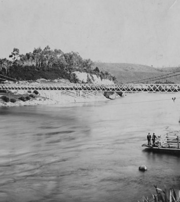
Milford or Piopiotahi Heritage - Milford Sound by Motorbike, 1990s: We were very fortunate to be donated a lot of old tourist slides and photos of the Fiordland or Te Rua-o-Te-Moko area and heritage sites within that. These are from 1991 and show the varied nature of the Fiordland scenery, from a motorbike tour along the Milford Road. Trips in other years by the same person, can be seen in other entries in this online community archive. IMAGES: 1 - view from the petrol station pumps at Milford Sound, with the three peaks - Mitre, Lion & Elephant in the background, in thick clouds. Note the Maui Camper Van on the other side of the gas pumps to the motorbike. And more campers in the car park at right, so this is not a recent phenomenon. 2 - view looking towards the mountains at 'Knob's Flat', a large new visitor and information centre is now at this site, with a place to camp if need be. 3 - an unknown view of a place in Fiordland on the Milford Road, although someone thinks it could potentially be taken at Cascade Creek. If anyone else can help us with any further information on these particular views or any other Milford or Tourism history from this time or earlier, that would be great. Please contact us or add a comment to this entry. And if anyone knows the history of the Petrol pumps here, we'd love to know! SOME EARLY HISTORY: Māori named Milford Sound, Piopiotahi, which is said to mean “a single piopio”. Māori belief is that when their legendary hero Maui died trying to win immortality for his beloved people, a piopio (a now long-extinct native bird) was said to have flown here in mourning, so that is their name for it. We cannot tell the story of early Milford without telling that of Donald Sutherland. He was to enter the head of Milford Sound, but not land there due to signs of natives (Māori), on 1 Dec 1877. When he left, he threw a message in a bottle dated 9 Dec 1877, with his name and 'Milford Sound.' As the weeks rolled around into 1878, Sutherland returned and started building a hut at the site of the present Milford Bay wharf, which was known as Freshwater Basin. After later adding 2 more huts, he started calling his settlement, 'The City of Milford'! After some months, he invited a prospector friend and they explored for both minerals and to discover what else was in the surrounding countryside. In doing so, Donald was to discover what he named as the 'Sutherland Falls', on 10 November 1880, which he first estimated at 3-4,000 feet or 915-1220 metres). This figure was later corrected by surveyor CW Adams to 1904 feet or 580 metres, but still an impressive sight none-the-less. These became the highlight of Milford. Hearing that the Wakatipu County Council were looking for a route to Milford, the two men appealed to them and were given a grant of £40 and they set off to explore any potential routes. They were entirely frustrated. By 1888, CW Adams, Chief Surveyor of Otago, who was intent in finding a track overland to Te Anau from Milford, commissioned Sutherland to cut a track from Milford to Sutherland Falls. This he did, for the princely sum of £50. That cutting was to end up being the 'Milford half' of the eventually famed Milford Track, and Sutherland with his assistants, cut it in 6 months! Another famed Fiordlander from the early days, Quintin MacKinnon, who was from the Shetland Islands and who had been living at Garden Point at Lake Te Anau, was to cut another track from the head of the lake up to the Clinton Valley. He was also commissioned by Surveyor Adams and paid £30. When Adams arrived with his survey party in Milford on 27 September 1888 he brought with him parties of photographers, who recorded the event and some of these photos can be seen elsewhere in this community archive. To cut a long story (or shall we say track?!) short, the survey and track cutting did not go as planned, with weather issues compounding things. But these things were eventually overcome, MacKinnon's Pass was found and then conquered, and the Milford Track was made, thanks to these brave souls. To make access easier to the famed Sutherland Falls and the Milford Track, it is notable, that from late 1888, McKerrow, the Surveyor-General, had planned to have a boat at Lake Ada, and to also improve the newly formed, surveyed track. It has been said that the first public person to fully traverse the new Milford Track was Te Anau's first settler, one Richard Henry, arriving January 1889. As other accounts also say he was the second ever person to walk the track (the first obviously being MacKinnon who found the pass over), this story is likely true. Later in 1889, the government steamer, 'Hinemoa', bought the surveyors back to carry on working on properly forming a track and building huts to work from. They had to take in all of their supplies, which was tough work. This took many years to improve. Dr Samuel Moreton's wife was he first woman ever recorded to walk the Milford Track and she wrote this piece of history into the visitors book, as one would! This was on 7 Feb 1890. What a remarkable woman. Later this same year, the earliest Milford resident and intrepid explorer, Donald Sutherland, married Mrs Elizabeth Samuel and moved her to Milford with him. Just six months later, he is recorded as having gifted her his 'City of Milford' and she went on to build an expansive Accommodation House at here in 1891, where for many years, weary travelers were welcomed. This has been said to be either a 10 or 12 room establishment, depending on which history you read. However many rooms it had, it was certainly large. This Accommodation House was to cater for visitors who came over the track from Te Anau, as well as those who came in from the sea. While all this was happening, Quintin MacKinnon was not idle either. He had set himself up at Garden Point, the South Fiord's entrance to Lake Te Anau, where he erected first tents, then a hut. He would bring in visitors who arrived at the coach road terminus at Te Anau, on his whaleboat Juliet, then guide them on the track and over the pass he had found and named, then across Lake Ada and the Sound, also by boat, then escort them on to Mrs Sutherland's at Milford, where they would find a comfortable welcome. In a sad twist of fate, Quintin MacKinnon was to be lost to the wilds of the Fiordland nature that he had helped tame, disappearing on November 1892. After weeks of him being missing and days of searching, his boat was found sunk in water with all of the supplies MacKinnon had been bringing back for the new track season, still in it. His body was never recovered and a cairn of remembrance was erected. It is noted that in the four brief years from the time he found MacKinnon Pass and ushered in a new lease of life for those in Milford and surrounds, he had gained an unsurpassed reputation as a generous, helpful guide. After MacKinnon's passing, the Ross brothers were to step up to do the guiding until the Tourist Department took over later on. The Department took over Glade House, and installed Robert Murrell as the Track Manager, he did maintanence and guiding on the Track and meet all of the many visitors needs. In fact he was such an institution, the place was known as "Murrell's Accommodation House" for many years. The building was extended and the Government finally started staffing and maintaining the track and huts as had been needed for many years. By 1906, the old Garvey building had been replaced, other hut sites were chosen and replaced and pack horses were to replace humans in carrying supplies. Te Anau Hotel was also purchased by the Tourist Department as well as the lake steamship 'Tarewa'. Prior to this, visitors could chose to use services or not, but after the take over, guiding fees were abolished and track walkers were all supervised by the government guides and so the track flourished. Donald Sutherland, the first resident of Milford, passed away in 1919, sadly his wife was left with the body for some time, as she could not move him. Such was the isolation of what Sutherland had called his 'City'. Elizabeth would not leave with his body, staying on to keep his legacy alive, until she too succumbed, some years later. Now both trailblazing men who had initially worked on finding a pass to connect the Milford Track had died. Tourism Department records during the 1930's show more and more sea traffic to Milford and the walking track and as we get head into the 1940's air travel starts to make an appearance. It is of note that now in 2024, air travel is one of the major ways visitors enter Fiordland and the Milford area. Although by sea is still offered as cruise ships of massive capacity come in. Many buses per day come down from Queenstown and the drive takes all day. Due to traffic accidents, the road is now closed during the night-time. But back to our look into the history of the building of the road and tunnel: What really put the Milford Track on the map, was the opening of the long awaited Homer Tunnel. From a route being found back in 1910, it took around 40 years to become a reality. From 1929 when the first work party staring on forming the road, which would include the tunnel, to 1940 when the tunnelers finally broke through, it was the 1954/55 season before private cars were able to use the new Homer Tunnel. The total of the extremely long tunnel project had come to over $1 million, after an initial quote by the Public Works Department of £2,000 back in 1890. When the tunnel was completed, you entered it on the Hollyford side where it sat at 3,023 feet or 921 m above sea level, and 3/4 of a mile or 1.2 km long and had a grade of one in ten, where you come out of it on the Milford side. We hope you enjoyed this brief history of the City of Milford and Milford Track! As the Milford Sounds is one of Aotearoa New Zealand's most visited spots for tourists, both international and national, we should all spare a thought for those enterprising explorers who found this place, and for those who worked long and hard, in difficult and dangerous conditions, often by force on unemployed labour work parties, to make road access possible, some even losing their lives. The risk remains and sometimes the road is still closed in avalanche weather. But the astounding views, especially of the famed Mitre Peak or Rahotu, make this long trip worthwhile. Mitre Peak was was named by Captain John Lort Stokes of the HMS Acheron, who saw the shape of it as similar to the mitre headwear of Christian bishops of the time. The Māori name for the peak is Rahotu, and it sits at 1683m of grandeur. VISITING IN THE CURRENT DAY: Milford Sounds visitor site tells us, "Milford Sound is located in a remote part of the South Island, with only one road leading to the world famous fiord. The Milford Road is not just a way to get to Milford Sound. It’s an unforgettable journey into the heart of Fiordland National Park. There are several ways to get to Milford Sound, including bus and coach travel, self-drive or air travel. The method you choose will depend on the amount of time you have, your budget and what type of traveller you are." For more information on this site, see the Place Notes below. Archivists comment: At the CWA Community & Heritage Hub, operated by Central & Western Archive - Murihiku Southland, we have books, records and photos on the history of this area, bush, mountains, tracks and more. Hopefully this entry will be added to as more information on the history comes to hand. If you or anyone you know has any more information or photos to share or accounts of Milford, the Sounds or the wider area of Fiordland or Te Rua-o-Te-Moko, please do share this with us in the comments section. You can do this by making a comment in the space provided under the image page. Or you can make contact with us as per the archive front page.
Ngā whakamārama
Details
-
Title
Milford or Piopiotahi Heritage - Milford Sound by Motorbike, 1990s
-
Maker
Unknown
-
Date made
1991
-
Subject
Fiordland, Te Rua-o-te-moko, Western Southland, Great outdoors, Fiordland National Park, Outdoor Adventure, Mountain Tops, Early Exploration, Sutherland, Donald & Elizabeth (his wife), MacKinnon, Quintin, Milford Sound, Piopiotahi, Aoteroa NZ, Milford Track, Motorcycle Touring, Fiordland, Te Rua-o-Te-Moko, Outdoors, Milford Sound, Piopiotahi, Milford Road, Milford, Tourism, Road Trip, The Sounds, Finding the Fiords, Maui Campers, Knobs Flat, Cascade Creek
-
Additional information
Digital only image in archive
-
Rights
Attribution (cc)
http://creativecommons.org/licenses/by/4.0/ -
View source record for this item
Kei hea tēnei taonga?
Where is this item held?
-
Additional information including high resolution images may be available.
-
Location
Main Rd, Tūātapere, next to the old Railway Station. We also belong to the internationally recognised 'Safe Space Alliance'.
Whare taonga | Organisation
Central & Western Murihiku Southland Archive
Ngā here ki runga i ngā whakaahua o tēnei taonga?
What can you do with images of this item?
-
You must check with Central & Western Murihiku Southland Archive to confirm terms of use and any attribution requirements, but this is our understanding:
-
Use for private study, research, criticism, review, or education
NZ Copyright law allows for the use of copyrighted works in specific circumstances. Consider what you can do under copyright law.
-
Share
You can share this image without further permission.
-
Modify or remix
You can modify, remix or add to this image without further permission.
-
Commercial use
You can use this image to make money.
-
Text adapted with permission from Te Papa and Digital NZ
Tāpirihia he kōrero anō
Improve this record
-
Can you help us? Share names, details and stories to help enrich the collection.