Tūātapere Township History - Tūātapere Main Street View from 1921
Shared by Central & Western Murihiku Southland Archive
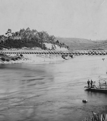
Tūātapere Township History - Tūātapere Main Street View from 1921, including Railway and Branch Line Buildings: We don't have a lot of information for this picture, except it was taken in 1921 by Dan Cronin. It shows the Main Road of Tūātapere from Ōrawia Road, when the township was a bustling, lively timber town. Of particular note is the bushline which is right behind Railway Row/Road. The foreground to the left, shows what is now 'Greenheart Reserve' and in this image, it is being used, we are told, by itinerant bushmen, who have set up what appear to be permanent tent type structures against free-standing chimneys, to live in (or they may be temporary shelters). It is known that early day tents were made to sit up against cooking/heating chimneys and they had a rectangular shape with solid ends which had a door in one, the sides being made with canvas stretched over wooden frames, and a canvas roof also stretched over a sloped frame, and this roofing canvas hung down over the sides of the canvas walls, to assist in water run-off, which is exactly what these 'huts' appear to be. If anyone has more information, please do share with us, as we would love to have the potential options confirmed. Over behind this, the Railway tracks can be clearly seen, with the Branch Line going through what is now 'Greenheart Reserve' along the bank of Boundary Creek. And timber appears to be stacked over the far side of the Railway Lines with most of the Branch Line buildings and Railway structures visible, including the Engine Shed and the 'high' water tower (neither of these still exist), further beyond that is the lower water tower (obscured) and the Railway Station itself with the Railway houses behind it to the left, along Railway Row/Road. There are also another collection of buildings situated alongside the Railway houses which we know nothing about. Can you help us with what these were? To the right, Boundary Creek Bridge can be seen and across that in the background and around the corner, can be seen the early Butcher's Residence that TJ Henderson built and lived in until his death, then next to that is the earlier Butcher's shop of Young & Aiken which TJ had bought off them. There are many more shops trailing off into the distance along the Main Road. You can also clearly see the bell tower of the Presbyterian Church (opened Jan 1917) and the buildings continue all the way along until the Waiau Hotel, which at the time this photo was taken, was being run by one JA Horner. We are currently doing more work to establish exactly what buildings were owned or leased by who and what they were used for, at the time this photo was taken, and as we find out this information, it will be shared in this image entry. Hopefully this entry will be added to as more information comes to hand. If you or anyone you know has any more information or photos to share or accounts of early businesses or buildings in Tūātapere during the years, please do share this with us in the comments section. You can do this by making a comment in the space provided under the image page. Or you can make contact with us as per the archive front page. Note: these entries are compiled with information provided by donors with the records, from locally reported news, from national and occasionally international reports in publications, from personal records made by the people themselves - such as their electoral enrollments, wills, war records etc., also from government and council held records such as births, deaths and marriages or cemetery information, also land ownership and rating records, and lastly, from community memories, such as those passed on by friends, family and contemporaries. It is not always possible to verify memories from others, so please let us know if you believe we have any incorrect information. If you believe that any public or personal record information quoted is wrong, if you can provide proof of any alternative fact to us in a document showing evidence of the correct details, that would be very helpful to us. Thank you.
Ngā whakamārama
Details
-
Title
Tūātapere Township History - Tūātapere Main Street View from 1921
-
Maker
Cronin, Dan
-
Date made
1921
-
Subject
Tūātapere, Railways & Roads, Railway Buildings, Greenheart Reserve, Tūātapere, Butchers, Boundary Creek, Tūātapere, Waiau District, Business & Industry, Young & Aitken, Henderson, TJ (Thomas John), Greenheart, Railway, Branch Line, Tūātapere Main Road, Young & Aitkin, TJ Henderson, early tents
-
Additional information
Digital image in archive Print copy in files
-
Rights
Public Domain
-
View source record for this item
Kei hea tēnei taonga?
Where is this item held?
-
Additional information including high resolution images may be available.
-
Location
Main Rd, Tūātapere, next to the old Railway Station. We also belong to the internationally recognised 'Safe Space Alliance'.
Whare taonga | Organisation
Central & Western Murihiku Southland Archive
Ngā here ki runga i ngā whakaahua o tēnei taonga?
What can you do with images of this item?
-
You must check with Central & Western Murihiku Southland Archive to confirm terms of use and any attribution requirements, but this is our understanding:
-
Use for private study, research, criticism, review, or education
NZ Copyright law allows for the use of copyrighted works in specific circumstances. Consider what you can do under copyright law.
-
Share
You can share this image without further permission.
-
Modify or remix
You can modify, remix or add to this image without further permission.
-
Commercial use
You can use this image to make money.
-
Text adapted with permission from Te Papa and Digital NZ
Tāpirihia he kōrero anō
Improve this record
-
Can you help us? Share names, details and stories to help enrich the collection.